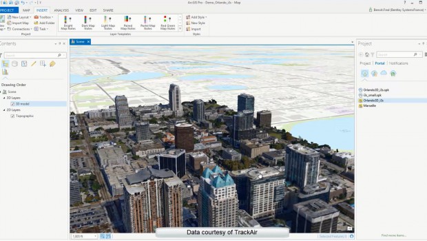
Bentley Systems agrees. The firm has showed that more projects are benefiting from geometrically accurate 3D models created by stitching together captured images using software like his company’s ContextCapture.
PUBLICITÉ
- New multi-resolution mesh support for third-party formats including Esri i3s, Google Earth KML, SpaceEyes3D, OSGB (OpenSceneGraph), and LODTreeExport formats.
- Multi-resolution mesh support for ContextCapture’s native 3MX format.
- A threefold increase from 30 to 100 gigapixels of imagery that can be processed with ContextCapture.
“I believe we will go on to see reality modeling answering the question as to how drones, mixed reality devices, the industrial Internet of Things will converge to advance infrastructure engineers, project delivery, and asset performance,” said Greg Bentley, CEO of Bentley Systems.
![[Exclu] Copac : « L’innovation et la sécurité sont au cœur de nos priorités »](/e-docs/00/02/62/A4/exclu-copac-innovation-securite-sont-ur-nos-priorites_620x350.jpg)